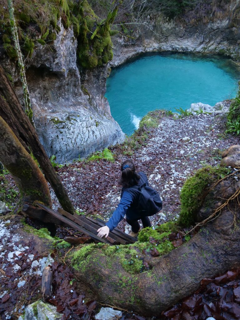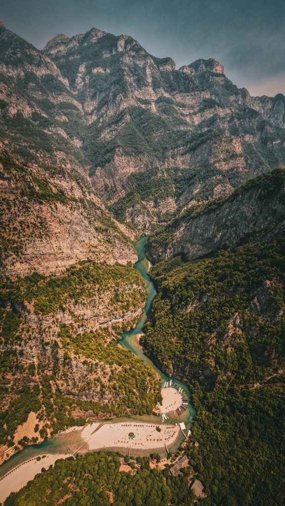
Qarku Tiranë

Tirana County

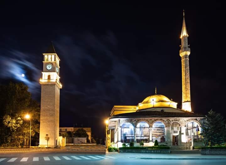
Xhamia e Et’hem Beut

Një nga atraksionet më të vizituara të Tiranës është xhamia e Et’hem Beut, e cila ndodhet në zemër të kryeqytetit shqiptar, në sheshin Skënderbej.

Si monument kulture i kategorisë së parë prej vitit 1948 dhe pjesë e qendrës historike të Tiranës, kjo xhami është ndër të paktat objekte të kultit në Shqipëri, që i shpëtoi shkatërrimit në vitet e regjimit diktatorial 50 vjeçar.

Xhamia e Et’hem Beut u ndërtua në fundin e shekullit të 18 dhe në fillim të shekullit të 19, nga pasardhësi i Sulejman Pashës, Molla Beu dhe u përfundua nga i biri, Haxhi Et’hem Beu. Arkitektura e mrekullueshme e xhamisë me harqet e bukura, minarenë, dritaret, sallat e brendshme, kubenë, shkallët dhe fasadat e pikturuara është impresionuese edhe sot e kësaj dite për turistë, studiues e vizitorët e shumtë, që vijnë në kryeqytet. Salla e madhe e lutjeve brenda saj është e mbuluar me kupolë gjysëm sferike dhe pa dritare. Punimet e drurit në sallat e brendshme të lutjeve janë të pasura në ornamente dhe forma gjeometrike të stilizuara bukur. Ndërsa portiku, apo siç njihet ndryshe në dialektin e Shqipërisë së mesme, hajati, është i shtruar me gurë, që mendohet se vijnë nga rrethinat malore të Tiranës. Xhamia e Et’hem Beut përfaqëson traditën orientale të ndërtimit dhe ka ndikuar në qendrën historike të Tiranës.  Ndriçimi i mbrëmjes i dhuron një bukuri të spikatur ndërtesës së xhamisë, duke e bërë dominuese në të gjithë sheshin Skënderbej.

Et’hem Bey Mosque

One of the most visited attractions in Tirana is the Et’hem Bey Mosque, located in the heart of the Albanian capital, in Skanderbeg Square.

Designated as a first-category cultural monument since 1948 and part of Tirana’s historic center, this mosque is one of the few religious buildings in Albania that survived destruction during the 50-year dictatorial regime.

The Et’hem Bey Mosque was constructed at the end of the 18th century and the beginning of the 19th century by the successor of Sulejman Pasha, Molla Beu, and was completed by his son, Haxhi Et’hem Bey. The mosque’s stunning architecture, with its beautiful arches, minaret, windows, inner halls, dome, stairs, and painted facades, remains impressive to this day for tourists, researchers, and numerous visitors to the capital. The mosque’s large prayer hall is covered with a semi-spherical dome and is windowless. The woodwork in the interior prayer halls is richly ornamented with beautifully stylized geometric shapes. The portico, or “hajati” as known in the dialect of central Albania, is paved with stones believed to originate from the mountainous surroundings of Tirana. The Et’hem Bey Mosque represents the oriental tradition of construction and has influenced the historic center of Tirana. The mosque’s evening lighting endows the building with a striking beauty, making it dominant in Skanderbeg Square.

Kulla e Sahatit

Kulla e Sahatit është një nga monumentet simbol të Tiranës. Ajo nisi të ndërtohej mes viteve 1822 – 1840. Ndërtimi i saj u financua nga familjet fisnike të Tiranës. Kulla e Sahatit ka 90 shkallë në formë spiraleje. Ajo është 35 metra e lartë dhe deri në vitin 1970 ka qenë ndërtesa më e lartë e kryeqytetit. Fillimisht Kulla e Sahatit kishte një kambanë të ardhur nga Venediku, e cila binte për çdo orë. Kulla e  Sahatit është simbol i emblemës së Bashkisë së Tiranës dhe së bashku me Xhaminë e Et’hem Beut  formon një ansambël arkitekturor unik, ansambli më i fotografuar i kryeqytetit. Prej ballkonit të Sahatit të Tiranës mund të shohësh shëshin kryesor të kryeqytetit dhe ansamblin e godinave historike.

The Clock Tower

The Clock Tower is one of Tirana’s symbolic monuments. Its construction began between 1822 and 1840, funded by Tirana’s noble families. The tower has 90 spiral steps, stands 35 meters tall, and was the tallest building in the capital until 1970. Originally, it had a bell from Venice that chimed every hour. The Clock Tower, a symbol of the Tirana Municipality’s emblem, together with the Et’hem Bey Mosque, forms a unique architectural ensemble, the most photographed in the capital. From the tower’s balcony, you can view Tirana’s main square and the complex of historic buildings.

Muzeu Historik Kombëtar

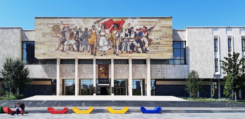
Muzeu Historik Kombëtar është ndërtuar në qendër të Tiranës, pranë sheshit “Skënderbej”, dhe spikat me mozaikun e tij në fasadën kryesore. Ky muze, i përuruar më 28 Tetor 1981, është një aset i rëndësishëm i trashëgimisë kulturore, historike e sociale të Tiranës.  

National Historical Museum

Located in central Tirana near Skanderbeg Square, the National Historical Museum is notable for its mosaic facade. Inaugurated on October 28, 1981, it is an important asset of Tirana’s cultural, historical, and social heritage.

Muzeu Historik ka formë perimetrale me një oborr të brendshëm. Ai organizohet me tetë pavione ekspozimi, si Pavioni i Lashtësisë, ai i Mesjetës, i Rilindjes Kombëtare, i Pavarësisë, i Ikonografisë, Etnokulturës, Luftës Antifashiste dhe Pavioni i Genocidit Komunist. Përveç tyre muzeu ka edhe mjediset e arkivit e të laboratorëve, salla për ekspozita të përkohshme dhe salla konferencash. Në mjediset e muzeut gjenden rreth 5000 objekte, të cilat i përkasin një periudhe relativisht të gjatë kohore, duke filluar nga mijëvjecari IV para Krishtit deri në gjysmën e dytë të shekullit XX. 

Mozaiku në fasadën kryesore të tij është një vepër e shtrirë në 400 metra katrorë.

Ai shpalos 13 figura të paraqitura në disa grupime, si grupi i luftëtarëve dhe shigjetarëve ilirë dhe shqiptarëve të luftës antiosmane, mandej përfaqësohet Rilindja Kombëtare me dy figura dhe partizani fitimtar. Ndërkohë dy figurat simbol, punëtori dhe fshatarja, janë në qendër të sipërfaqes së mozaikut dhe figurat e tjera krah tyre simbolizojnë Luftën Antifashiste Nacionalçlirimtare. 

Autorë të mozaikut të Muzeut Historik Kombëtar janë piktorët Vilson Kilica, Josif Droboniku, Agim Nebiu, Anastas Kostandini dhe Aleksandër Filipi. 

Mozaiku iu nënshtrua restaurimit me fonde të Bashkimit Europian. Muzeu Historik Kombëtar qëndron i hapur për të gjithë vizitorët dhe turistët e huaj, të cilët janë të interesuar të njohin historinë shqiptare.

The museum has a perimeter shape with an inner courtyard and features eight exhibition pavilions, including the Pavilions of Antiquity, Middle Ages, National Renaissance, Independence, Iconography, Ethnography, Anti-Fascist War, and Communist Genocide. Additionally, it houses archive and laboratory spaces, temporary exhibition halls, and conference rooms. The museum’s collection includes about 5000 objects spanning from the 4th millennium BC to the second half of the 20th century.

The facade’s mosaic covers 400 square meters. It depicts 13 figures in various groups, such as Illyrian warriors and archers, Albanians of the anti-Ottoman war, National Renaissance figures, and a victorious partisan. The central figures, a worker and a peasant woman, are surrounded by other figures symbolizing the National Liberation Anti-Fascist War.

The mosaic was created by painters Vilson Kilica, Josif Droboniku, Agim Nebiu, Anastas Kostandini, and Aleksandër Filipi and was restored with funding from the European Union. The National Historical Museum welcomes all visitors and foreign tourists interested in learning about Albanian history.

Mozaiku i Tiranës

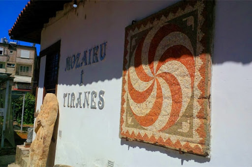
Mozaiku i Tiranës është monument kulture i kategorisë së I, që prej vitit 1973. Monumenti arkeologjik konsiston në rrënojat e një ndërtese të periudhës antike, të cilat u zbuluan rastësisht në vitin 1972, gjatë ndërtimit të pallateve të bllokut “Partizani”.

Në rrënojat e zbuluara duken tre ambiente të dekoruara me mozaikë kryesisht me motive gjeometrike. Sipas studiuesve të arkeologjisë dhe monumenteve të kulturës kemi të bëjmë me një qendër fshatare të shekujve të parë pas Krishtit, që në fillim të shek. III u zëvendësua me një vilë fshatare të tipit “rustika”. 

Siti arkeologjik “Mozaiku i Tiranës” është kthyer në një nga atraksionet më të vizituara nga turistët në kryeqytet.

Mozaiku në fasadën kryesore të tij është një vepër e shtrirë në 400 metra katrorë.

Ai shpalos 13 figura të paraqitura në disa grupime, si grupi i luftëtarëve dhe shigjetarëve ilirë dhe shqiptarëve të luftës antiosmane, mandej përfaqësohet Rilindja Kombëtare me dy figura dhe partizani fitimtar. Ndërkohë dy figurat simbol, punëtori dhe fshatarja, janë në qendër të sipërfaqes së mozaikut dhe figurat e tjera krah tyre simbolizojnë Luftën Antifashiste Nacionalçlirimtare. 

The Mosaic of Tirana

The Mosaic of Tirana is a cultural monument of category I, dating back to 1973. This archaeological monument consists of the ruins of an ancient building that were accidentally discovered in 1972 during the construction of the “Partizani” residential complex.

Within the discovered ruins, three rooms adorned with mostly geometric mosaic patterns can be seen. According to archaeologists and cultural heritage experts, this site represents a rural settlement from the early centuries after Christ, which was later replaced by a “rustic” villa in the beginning of the 3rd century. 

The archaeological site “The Mosaic of Tirana” has become one of the most visited attractions by tourists in the capital city.

The mosaic on its main facade is a work spread over 400 square meters.

It unfolds 13 figures presented in several groups, such as the group of Illyrian and Albanian warriors and archers of the anti-Ottoman war, then the National Revival is represented by two figures and the victorious partisan. Meanwhile, the two symbolic figures, the worker and the peasant, are in the center of the mosaic surface and the other figures next to them symbolize the Anti-Fascist National Liberation War.

Sarajet e Toptanëve

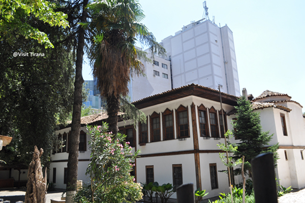
Sarajet, një banesë karakteristike tiranase e stilit oriental gjenden në rrugën “Abdi Toptani”, në qendrën historike të kryeqytetit. 

Kjo ndërtesë dykatëshe e ndërtuar me mure qerpiçi dhe skelet druri në katin e sipërm, paraqet interes për ndërtimin funksional, arkitekturën dekorative të godinës si dhe kompozimin në një ansambël të vetëm me ndërtimet përreth. 

The Toptani Sarajet

The Sarajet, a characteristic Oriental-style house found on “Abdi Toptani” street, in the historical center of the capital city of Tirana. 

This two-story building constructed with brick walls and a wooden frame on the upper floor is of interest due to its functional design, decorative architecture, and its composition as a unique ensemble with the surrounding buildings. 

Sarajet e Toptanëve u ndërtuan rreth viteve 1833-1840 dhe janë ndër të paktat saraje feudalësh, të cilat i kanë mbijetuar kohës. Ndërtesa e orientuar nga juglindja përbëhet nga 32 ambiente në stilin oriental, ku bien në sy dhoma e zjarrit”, çardaku, hajati, shkallet e hapura dyrampeshe në pjesën ballore. 

Kjo godinë karakteristike për shtresën e feudalëve të mëdhenj shqiptarë në shek. e XVIII dhe  XIX në zonën e Tiranës është restauruar dhe rikonstruktuar përgjatë fillimit të viteve 2000 për t’u kthyer në një restorant dhe kafe për disa vite. 

Si Monument Kulture i Kategorisë së Parë, Sarajet e Toptanëve do të gëzojnë edhe statusin “shtëpi muze”. Në njërin kat do të jetë Muzeu Etnografik i Tiranës, kurse kati tjetër do të jetë për përkujtimin e marrëdhënieve speciale Shqipëri – Amerikë, duke qenë se në kë godinë ka qenë selia e parë e legatës Amerikane në Tiranë. 

Pas tërmetit të datës 26 nëntor 2019, është hartuar një studim i plotë në bashkëpunim me Ministrinë e Kulturës për të restauruar tërësisht objektin duke shtuar dhe hapësira të tjera për funksionimin më të mirë të tij. 

The Toptani Sarajet were built around the years 1833-1840 and are among the few feudal mansions that have survived the test of time. The building, oriented towards the southeast, consists of 32 rooms in the Oriental style, including a “dhoma e zjarrit” (fireplace room), a “çardak” (open balcony), a “hajati” (porch), and open staircases on the eastern side. 

This distinctive building, representative of the prominent Albanian feudal class in the 18th and 19th centuries in the Tirana region, was restored and reconstructed at the beginning of the 2000s to be converted into a restaurant and café for several years. 

As a Cultural Monument of the First Category, the Toptani Sarajet will also enjoy the status of a “house museum.” One floor will house the Ethnographic Museum of Tirana, while the other floor will serve as a memorial to the special relationship between Albania and the United States since this building was the first headquarters of the American legation in Tirana. 

Following the earthquake of November 26, 2019, a comprehensive study has been undertaken in collaboration with the Ministry of Culture to fully restore the facility, adding additional spaces for its improved functionality. 

Ura e Tabakëve

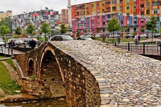
Ura e Tabakëve është e ndërtuar në gjysmën e parë të shekullit XVIII, nga esnafi i Tabakëve prej të cilit mori edhe emrin. Asokohe kjo urë shërbente për të lidhur dy pjesët e qytetit, të cilat ndaheshin nga lumi i Lanës. Në njërën anë sillej nga fshati në qytet gjëja e gjallë dhe në anën tjetër ishin zejtarët dhe shitësit e lëkurës, njëri prej të cilëve ishte esnafi. Në vitin 1930 lumi i Lanës u devijua dhe ura nuk kishte më një funksion të rëndësishem tregtar, si rrjedhojë nisi të rrënohej. Në ditët e sotme “Ura e Tabakëve” është restauruar dhe është kthyer në një atraksion turistik, që vizitohet nga turistët e sigurisht përdoret edhe nga kalimtarët për të shkuar drejt qendrës historike. 

The Tabak Bridge

The Tabak Bridge was built in the first half of the 18th century by the Tobacco Guild, from which it got its name. At that time, this bridge served to connect two parts of the city that were divided by the Lana River. On one side, it was used by the villagers coming into the city with their livestock, while on the other side, it was frequented by craftsmen and leather sellers, one of whom belonged to the Tobacco Guild. In 1930, the Lana River was diverted, and the bridge lost its important commercial function, leading to its gradual deterioration.
In recent days, the “Tabak Bridge” has been restored and turned into a tourist attraction, visited by tourists and used by pedestrians to access the historical center.
 

Shtëpia e piktorit Sali Shijaku

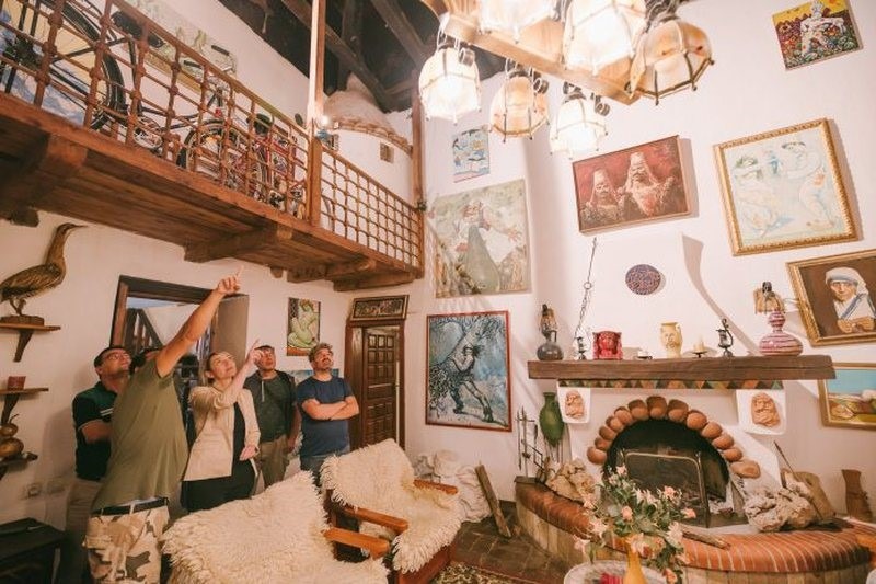
Një nga shembujt më të bukur të arkitekturës tipike tiranase të shekullit të 19 është shtëpia e piktorit Sali Shijaku, pranë rrugës “Siri Kodra”, Monument Kulture i Kategorisë së Parë. Kjo banesë ndodhet në një nga rrugët, që të drejtojnë pranë qendrës së Tiranës dhe është banuar nga piktori i njohur edhe në ditët e sotme. Shtëpia tashmë funksionon si restorant tradicional dhe galeri arti ku janë të ekspozuara 100 punime e vepra në pikture të koleksionit të piktorit Sali Shijaku. Godina është një atraksion për turistët e huaj, që vizitojnë Tiranën dhe ku njihen e prekin nga afër traditën historike tiranase në arkitekturën e dekorimin e banesave. 

The House of Painter Sali Shijaku

One of the most beautiful examples of typical 19th-century Tirana architecture is the house of the painter Sali Shijaku, located near “Siri Kodra” street, designated as a Cultural Monument of the First Category. This residence is situated on one of the streets leading to the center of Tirana and is still inhabited by the renowned painter to this day. The house now functions as a traditional restaurant and an art gallery where 100 paintings and artworks from the collection of the painter Sali Shijaku are exhibited. The building serves as an attraction for foreign tourists visiting Tirana, allowing them to get up close and experience the historical Tirana tradition in the architecture and decoration of homes. 

Tyrbja e Kapllan Pashës

Tyrbja e Kapllan Pashë Toptanit është ndërtuar në fillim të shek XIX në qendër të Tiranës, aty ku sot është ndërtuar një nga ndërtesat hoteliere më të larta të kryeqytetit, “Maritim Plaza”. Feudalet e rëndësishëm dhe familjet fisnike e kishin si traditë që ndërtonin një tyrbe në nder të tyre. Tyrbja e Kapllan Pashë Toptanit u ndërtua në vitin e vdekjes së tij më 1817, dhe i mbijetoi viteve dhe regjimit diktatorial. Sot, është një nga atraksionet e pakta të qendrës historike të Tiranës, dhe shpeshherë edhe vendi i përzgjedhur për foto nga turistët e vizitorët. 

The Mausoleum of Kapllan Pasha Toptani

The Mausoleum of Kapllan Pasha Toptani was constructed in the early 19th century in the center of Tirana, where one of the tallest hotel buildings in the capital, “Maritim Plaza,” now stands. It was a tradition among prominent feudal lords and noble families to build a mausoleum in their honor. The Mausoleum of Kapllan Pasha Toptani was built in the year of his death in 1817 and has survived through the years and different regimes. Today, it is one of the few attractions in the historical center of Tirana and is often chosen as a location for photographs by tourists and visitors. 

Tyrbja e Nuses

Tyrbja e Nuses është një nga monumentet e trashëgimisë kulturore të fshatit Mullet, pranë Petrelës, në rrethin e Tiranës. Ajo gjendet pranë Kishës së Maxharës në fshatin Mullet. Nisur nga funksioni i ngjashëm me varret monumentale të periudhës osmane, mendohet se ajo daton në fund të shek XV dhe fillim i shek XVI. Kjo tyrbe mbart një legjendë për nusen e re që mbeti e vrarë ditën e martesës nga një grindje mes dy palësh kundërshtare, që u kryqëzuan në hyrje të fshatit dhe në kujtim të saj u ndërtua “Tyrbja e nuses”.

Peizazhi i gjelbëruar rrethepërqark këtij monumenti dhuron momente qetësie e çlodhjeje. 

The Bride’s Mausoleum

The Bride’s Mausoleum is one of the cultural heritage monuments in the village of Mullet, near Petrela, in the Tirana district. It is located near the Church of Maxhara in the village of Mullet. Given its similar function to monumental graves from the Ottoman period, it is believed to date back to the late 15th and early 16th centuries. This mausoleum carries a legend about a young bride who was killed on her wedding day during a dispute between two opposing parties who crossed paths at the village’s entrance. In her memory, the “Bride’s Mausoleum” was built.

The lush green landscape surrounding this monument provides moments of tranquility and relaxation. 

Varri monumental në Persqop

Varri Monumental në Përsqop ndodhet 3.3 km larg qendrës së Petreles, përballë malit të Dajtit, në grykën që të çon në fshatin Shëngjergj, pranë Tiranës. Bazuar në zbulimet arkeologjike ndërtimi përkon me periudhën e njohur si “Periudha qytetare ilire”, ku dallohen ndikimet e kulturës helene. Ky atraksion turistik i restauruar tërheq prej vitesh vëmendjen e turistëve të apasionuar pas historisë dhe antikitetit. 

The Monumental Grave in Përsqop

The Monumental Grave in Përsqop is located 3.3 km away from the center of Petrela, facing Mount Dajti, in the gorge that leads to the village of Shëngjergj, near Tirana. Based on archaeological discoveries, its construction coincides with the period known as the “Illyrian urban period,” where influences of Hellenic culture can be observed. This restored tourist attraction has been attracting the attention of history and antiquity enthusiasts for years. 

Qarku Durrës

Durrës County

Mozaiku i Orfeut 

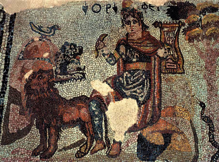
Mozaiku i Orfeut është zbuluar gjatë gërmimeve arkeologjike të vitit 1988 në Durrës dhe përfaqëson një nga shprehjet më të bukura të artit romak në qytet. Në panelin kryesor të mozaikut Orfeu shfaqet i ulur mbi një shkëmb në shkretëtirë rrethuar me motive bimore dhe gjeometrike. Ai veçohet nga pjesa tjetër e dyshemesë nëpërmjet një kornize komplekse. Tematika e Orfeut midis kafshëve ka qenë mjaft popullore gjatë shek. II – IV, dhe është e vetmja nga disa skena të mbështetura në mitin e Orfeut, që gjeti jehonë në artin romak. Mozaiku i Orfeut është vlerësuar si një vepër me vlera të rralla për figuracionin e pasur dhe realizimin e tij.

The Mosaic of Orpheus 

The Mosaic of Orpheus was discovered during archaeological excavations in Durrës in 1988 and represents one of the most beautiful expressions of Roman art in the city. In the central panel of the mosaic, Orpheus is depicted seated on a rock in a wilderness surrounded by floral and geometric motifs. He stands out from the rest of the floor through a complex border. The theme of Orpheus among the animals was quite popular during the 2nd to 4th centuries and is the only one among several scenes based on the myth of Orpheus that found its echo in Roman art. The Mosaic of Orpheus has been recognized as a work of rare value for its rich figurative representation and its execution.

Bukuroshja e Durrësit 

“Bukuroshja e Durrësit” është mozaiku më i lashtë dhe më i rëndësishëm i zbuluar në Shqipëri. 

Ai është një mozaik polikromatik i shek. IV p.e.s. me një sipërfaqe prej 9 metrash katrorë dhe ka formë eliptike. Mozaiku “Bukuroshja e Durrësit” paraqet figurën e një gruaje të bukur në një sfond të zi, të rrethuar me lule e elemente zbukurues. Për herë të parë ky mozaik u zbulua gjatë punimeve të ushtrisë austriake për hapjen e një transheje fortifikuese në vitin 1916. Oficeri austriak Camillo Prashnicher, një arkeolog i shquar u kujdes që shtresa e mozaikut të ruhej. Ai ishte i pari që publikoi fotografinë e mozaikut në një libër të tij kushtuar zbulimeve arkeologjike në Shqipëri. 

Në vitin 1959, kjo kryevepër 2300 – vjeçare e artit të lashtë figurative u rizbulua në themelet e një shtëpie dykatëshe, vetëm 150 metra pas godinës së teatrit “Aleksandër Moisiu” të qytetit të Durrësit. Në lashtësi mozaiku u quajt “Bukuroshja e Durrësit”, si një metaforë në nderim të grave të bukura qytetit të lashtë dhe mjeshtërve ilirë dhe zbukuronte një banjë luksoze të qytetit antik. Ai u krijua me gurë zalli natyror me ngjyra të ndryshme të ngjitura mjeshtërisht me njëra – tjetrën. 

“Bukuroshja e Durrësit” është një nga monumentet më të vizituara nga turistët dhe ajo i shton bukurinë dhe vlera të paçmuara qytetit antik të Durrësit apo Dyrrahium, siç njihej në lashtësi. Në vitin 1982 mozaiku “Bukuroshja e Durrësit” u zhvendos nga Durrësi në sallën kryesore të Antikitetit në hyrje të Muzeut Historik Kombëtar në Tiranë. 

The Beauty of Durrës 

“The Beauty of Durrës” is the oldest and most significant mosaic discovered in Albania.  

It is a polychrome mosaic from the 4th century BCE, with an elliptical shape and an area of 9 square meters. “The Beauty of Durrës” depicts the figure of a beautiful woman against a black background, surrounded by flowers and decorative elements. This mosaic was first uncovered during the construction of a fortification trench by the Austrian army in 1916. Austrian officer Camillo Prashnicher, a distinguished archaeologist, took care to preserve the mosaic layer. He was the first to publish a photograph of the mosaic in a book dedicated to archaeological discoveries in Albania.

In 1959, this masterpiece of 2300-year-old figurative art was rediscovered in the foundations of a two-story house, just 150 meters behind the “Aleksandër Moisiu” theater in the city of Durrës. In antiquity, the mosaic was called “The Beauty of Durrës” as a metaphor in honor of the beautiful women of the ancient city and the skilled Illyrian artisans. It adorned a luxurious bathhouse in the ancient city and was created using natural stones with different colors intricately arranged next to each other. 

“The Beauty of Durrës” is one of the most visited monuments by tourists and adds to the beauty and priceless value of the ancient city of Durrës, known as Dyrrachium in antiquity. In 1982, the mosaic “The Beauty of Durrës” was relocated from Durrës to the main hall of Antiquity at the National Historical Museum in Tirana. 

Kisha e Shën Ndojit 

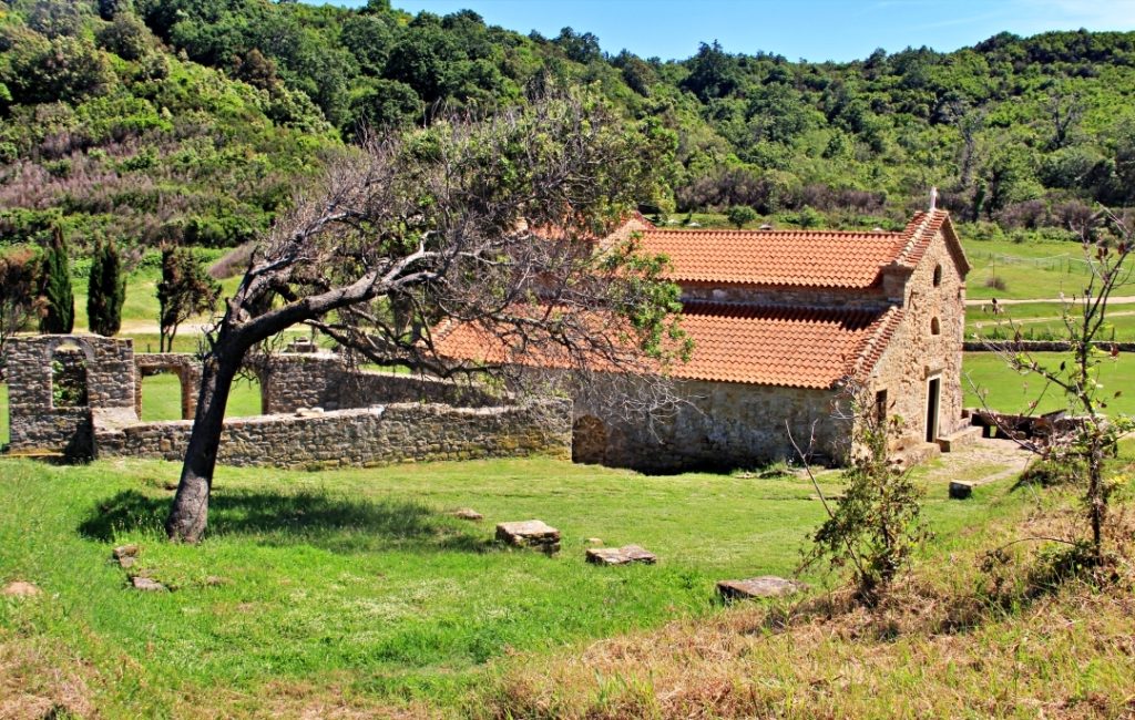
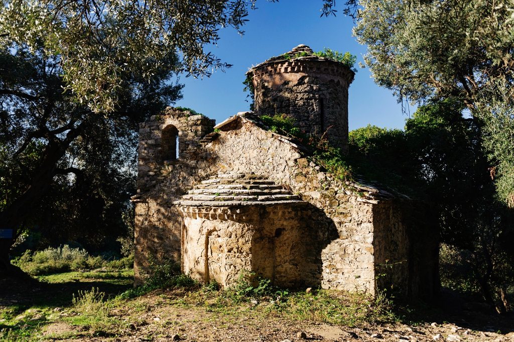
Kisha e Shën Ndojit apo Shna Ndout siç njihet ndër besimtarë është një nga kishat më të bukura dhe më të njohura të periudhës së Mesjetës në Shqipëri. Ajo gjendet në bregun e detit Adriatik, në anën veriore të Kepit të Rodonit dhe ka një pamje që mrekullon besimtarë e vizitorë të huaj e vendas. Kisha e Shën Ndojit përmendet në dokumentet historike si Kisha e Shën Anastasias e shek. XVIII – XIV. Në shek. XV ajo u mor në zotërim nga misionarët françeskanë, të cilët kryen një restaurim të saj dhe që nga ajo kohë kisha njihet me emrin e Shën Antonit. Kisha e Shën Ndojit është monument i trashëgimisë kulturore dhe për ndërtimin e saj është përdorur teknika bizantine e klausonazhit, ndërsa dallohen edhe elementë të arkitekturës romanike dhe gotike, si harqet me majë, të shek. XIII. Ndër fragmentet e ruajtura nga piktura murale paraqitet një shqiponjë dykrenore, si dhe një kalorës i ri pa mjekër dhe dy shpendë. Për shkak të vendosjes së saj në një peizazh magjepsës mbi det dhe vlerave të rralla të trashëgimisë kulturore e historike, kisha e Shën Ndout është një nga destinacionet turistike më të vizituara. 

The Church of St. Ndout 

The Church of St. Ndout, also known as Shna Ndout among believers, is one of the most beautiful and well-known churches of the medieval period in Albania. It is located on the shores of the Adriatic Sea, on the northern side of the Cape of Rodon, and offers a breathtaking view for both local and foreign visitors. The Church of St. Ndout is mentioned in historical documents as the Church of St. Anastasia from the 13th to 14th centuries. In the 15th century, it came into the possession of Franciscan missionaries who carried out its restoration, and since then, the church has been known by the name of St. Anthony.The Church of St. Ndout is a cultural heritage monument constructed using Byzantine cloisonné technique, with elements of Romanesque and Gothic architecture, such as pointed arches from the 13th century. Among the preserved fragments of mural paintings, a two-headed eagle and a young rider without a bridle, as well as two birds, can be seen.Due to its location in a captivating landscape overlooking the sea and its rare cultural and historical heritage, the Church of St. Ndout is one of the most visited tourist destinations.
 

Muret e Portës ose Porto Romano 

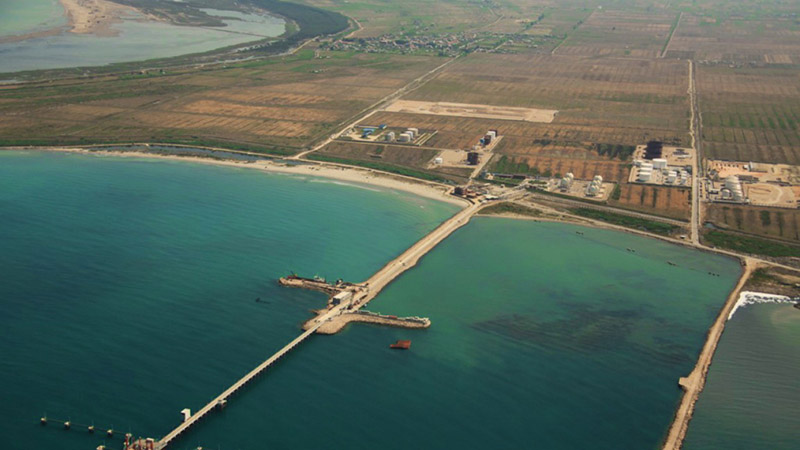
Porto Romano ndodhet rreth 7 km në veri të qytetit të Durrësit, në vendin e quajtur Porto Romano. Ai shërbente dikur për të mbyllur rripin e ngushtë të tokës, ndërmjet detit dhe kënetës. Muri i portës u ndërtua për të mbrojtur qytetin e Durrësit prej një sulmi të mundshëm nga Veriu, duke shfrytëzuar në këtë rast dhuntitë e terrenit, afërsinë e detit me kënetën e Durrësit. 

Kjo vërtetohet edhe me ngjarjen e sulmit që pësoi Durrësi nga ushtritë e Cezarit. Shekuj më vonë, kur muri i portës nuk funksiononte më, në një prej kodrinave në veri të Durrësit vendosën kampin e tyre normanët, të cilët e pushtuan qytetin. Muri i Portës përfaqëson një vepër të Justinianit I, i cili sipas Prokopit të Cezaresë, ndërtoi në Durrës një kala të re.

The Walls of the Gate or Porto Romano 

Porto Romano is located approximately 7 km north of the city of Durrës, in a place called Porto Romano. It once served to close off the narrow strip of land between the sea and the bay. The gate’s wall was built to protect the city of Durrës from a possible attack from the north, taking advantage of the natural terrain and the proximity of the sea to the bay of Durrës. 

This is evidenced by the historical event of the attack suffered by Durrës from the armies of Caesar. Centuries later, when the gate’s wall no longer served its function, the Normans established their camp on one of the hills north of Durrës, eventually conquering the city. The Gate’s Wall represents a work of Justinian I, who, according to Procopius of Caesarea, built a new fortress in Durrës.

Rotonda 

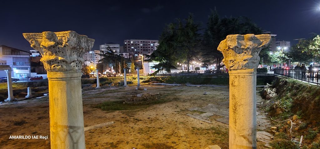
Rotonda apo Pazari i vjetër është zbuluar në vitet 1987 – 1990 dhe është shpallur monument kulture në vitin 2003. Ky Pazar u zbulua nga disa arkeologë, nga kërkimet e të cilëve dolën në dritë rrënojat e një sheshi – tregu të periudhës bizantine. 

Mendohet se monumenti është ndërtuar në shek. II p.e.s deri ne shek. IV p.e.s. dhe ka funksionuar si i tillë deri në shek. VII. 

Me vonë Pazari i vjetër u kthye në varreza. Monumenti është kompozuar në formën e një portiku rrethor, në mesin e të cilit gjendet një podium. Ky monument ka shërbyer si shesh publik ku organizoheshin panairet.

The Rotunda 

The Rotunda, also known as the Old Bazaar, was discovered in the years 1987-1990 and was declared a cultural monument in 2003. This market was uncovered by several archaeologists, whose research revealed the ruins of a square-market from the Byzantine period. 

It is believed that the monument was constructed between the 2nd century BCE and the 4th century CE and functioned as such until the 7th century.  

Later on, the Old Bazaar was transformed into burial grounds. The monument is composed in the form of a circular colonnade, within which a podium is located. This monument served as a public square where fairs were organized.

Bazilika e Shën Mëhillit 

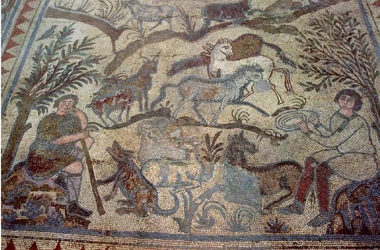
Bazilika e Shën Mëhillit ndodhet e pozicionuar në faqen perëndimore të kodrës me të njëjtin emër, në zonën e Arapajt, rreth 6 km nga qyteti i Durrësit. Ajo ka dalë në dritë nga fushatat arkeologjike të viteve ’80, të shekullit të shkuar. Dyshemeja e këtij ambienti është e shtruar me mozaik polikrom, me figura antropomorfe, zoomorfe dhe dekor bimor e gjeometrik. Ai është një ndër mozaikët paleokristianë më të bukur në vendin tonë, i datuar në shek. V – VI pas Krishtit.

Basilica of St. Mëhill 

The Basilica of St. Mëhill is situated on the western side of the hill with the same name, in the Arapaj area, approximately 6 km from the city of Durrës. It was uncovered through archaeological campaigns in the 1980s. The floor of this area is covered with a polychrome mosaic featuring anthropomorphic, zoomorphic, and geometric figures. It is one of the most beautiful paleochristian mosaics in our country, dating back to the 5th-6th centuries AD.

Kisha e Shën Premtes 

Kjo kishë është një Monument i Trashëgimisë Kulturore, i llojit “Arkitekturë” në  Rrethin e  Kavajës. Kjo kishë është e veçantë pasi është e vetmja kishë me arkitekturë gotiko – romake e mbetur në territorin e Shqipërisë. Kisha mendohet të jetë ndërtuar në shekullin e XIII. 

The Church of St. Friday 

This church is a Cultural Heritage Monument of the “Architecture” type in the Kavajë district. It is unique because it is the only church with Gothic-Romanesque architecture remaining in the territory of Albania. The church is believed to have been built in the 13th century. 

Qarku Kukës

Kukes District

Shpella e Dragobisë

Shpella e Dragobisë është e llojit karstik dhe është shpallur Monument Natyre. 

Ajo ndodhet në lartësinë 1200 m mbi nivelin e detit, pranë fshatit Dragobi të komunës Margegaj në rrethin e Tropojës.  Në histori njihet edhe me emrin shpella e Bajram Currit, pasi aty u strehua Bajram Curri. Shpella e Dragobisë shtrihet në të djathtë të luginës së Valbonës, në fundin e një rrëpire shkëmbore dhe ka formën e një guve karstike me gjatësi rreth 8 m, dhe lartësi  2 – 4 m.

Kjo shpellë e ndodhur midis pyjeve të ahut, në një pozicion mjaft të mbrojtur është një vend i pazbuluar dhe, që nuk vizitohet shumë nga turistët, ndoshta edhe për shkak të terrenit të thyer malor. Rrugëtimi në këtë zonë kërkon guida të specializuara lokale.

The Dragobia Cave

The Dragobia Cave is a karstic type of cave and has been declared a Natural Monument. It is located at an altitude of 1200 meters above sea level, near the village of Dragobi in the Margegaj municipality of the Tropoja district. In history, it is also known as Bajram Curri’s cave, as Bajram Curri sought refuge there. The Dragobia Cave is situated to the right of the Valbona Valley, at the end of a rocky slope, and it takes the form of a karstic hollow with a length of about 8 meters and a height of 2-4 meters.

This cave, nestled among beech forests and in a well-protected location, remains undiscovered and is not frequently visited by tourists, possibly due to the challenging mountainous terrain. Traveling to this area requires specialized local guides.

Mulliri i Bajram Currit

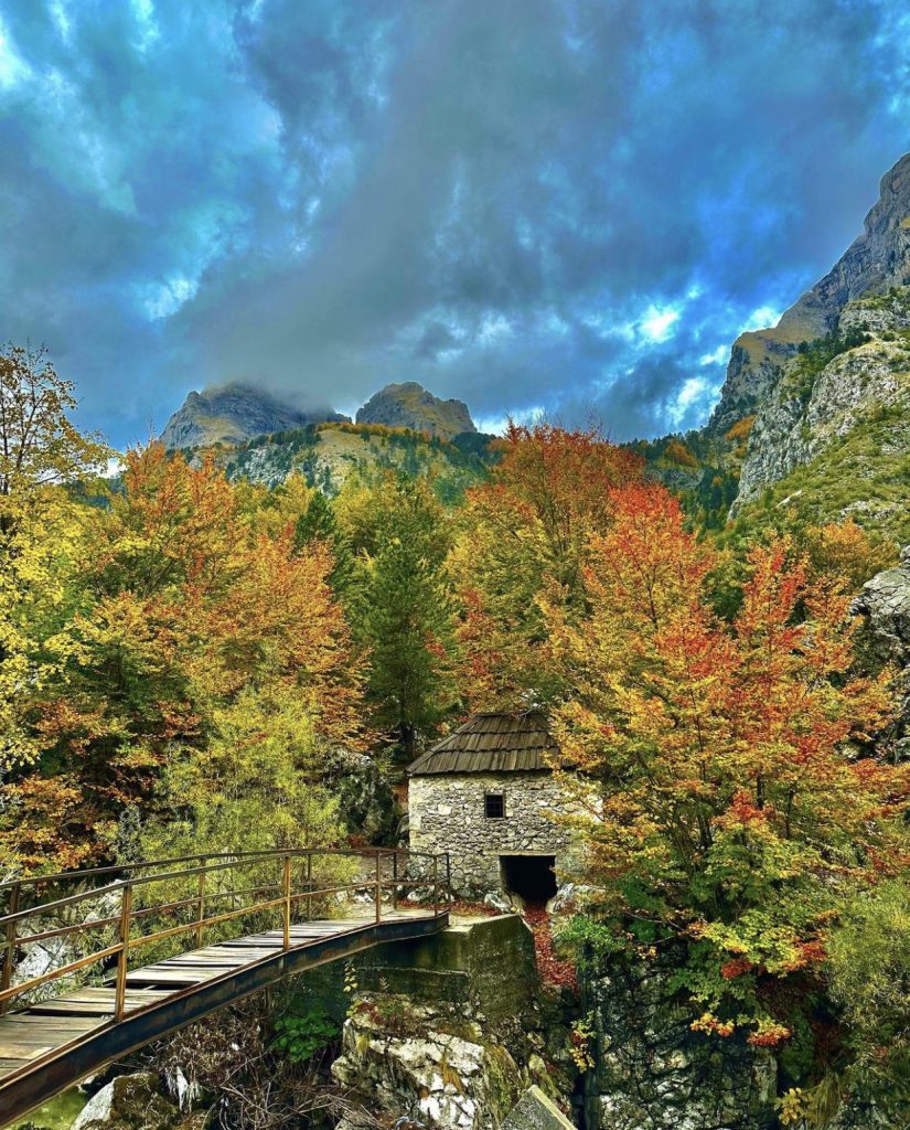
Në rrjedhën e ujërave të lumit të Valbonës, pranë urës të Shoshanit, 120 vite më parë është ngritur ky mulli që quhet Mulliri i Bajram Currit. Për vlerat e shumta historike e arkitekturore u shpall monument i kategorisë së parë në vitin 1979. Mulliri është vetëm katër kilometra larg qytetit të Bajram Currit dhe rrethohet nga një natyrë mahnitëse, në një prej hapësirave natyrore më frymëzuese të veriut të Shqipërisë.

The Bajram Curri Mill

The Bajram Curri Mill was erected 120 years ago on the waters of the Valbona River, near the Shoshani Bridge. Due to its numerous historical and architectural values, it was declared a first-category monument in 1979. The mill is only four kilometers away from the town of Bajram Curri and is surrounded by breathtaking nature, in one of the most inspiring natural spaces in northern Albania.

Lumi i Gashit 

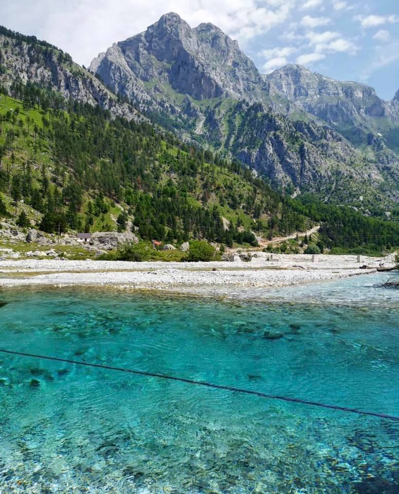
Lumi i Gashit është një nga mrekullitë natyrore të Shqipërisë, e mbrojtur UNESCO, si një nga natyrat më të paprekura në Shqipëri. UNESCO ka përfshirë dy rezervate natyrore të Shqipërisë në listën e trashëgimisë botërore të natyrës, pikërisht për pyjet e vjetra të ahut në lumin e  Gashit në pellgun e Parkut Kombëtar të Valbonës dhe Rrajcën. 

Një pjesë e madhe e sipërfaqes së Lumit të Gashit mbulohet me pyje të virgjëra ahu. Territori i mbrojtur rigorozisht është habitat për ariun e murrmë, kaprollin, ujkun, derrin e egër, thëllëzën e malit, gjelin e egër, zhgabën. Pellgu gjeografik përshkohet nga rrjedha ujore, të cilat prej dekadash kanë ndihmuar botën e gjallë të lulëzojë dhe jetojë e qetë, e patrazuar nga dora e njeriut. Lumi i Gashit dhe lugina përreth tij janë një nga zonat më tërheqëse të turizmit malor në Alpet e Shqipërisë.

The Gashi River

The Gashi River is one of the natural wonders of Albania, protected by UNESCO as one of the most pristine natural areas in the country. UNESCO has included two natural reserves in Albania on the World Heritage List, specifically for the old beech forests along the Gashi River in the valley of Valbona National Park and Rrajca.

A significant part of the Gashi River is covered by virgin beech forests. The strictly protected area is a habitat for various wildlife species, including brown bears, chamois, wolves, wild boars, lynxes, and more. The geographic valley is crossed by flowing waters that have supported the flourishing and undisturbed natural world for decades, untouched by human hands. The Gashi River and its surrounding valley are one of the most attractive areas for mountain tourism in the Albanian Alps.

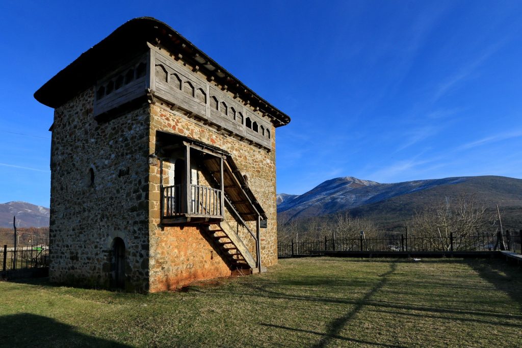
Kulla e Mic Sokolit 

Një tjetër monument kulture me rëndësi të veçantë është Kulla e Mic Sokolit, e cila gjendet në fshatin Bujan të Tropojës. Ajo është Monument Kulture i Kategorisë së Parë e shpallur në vitin 1974. Ndërtimi i saj daton në shek. XVIII, dhe është një banesë tradicionale trekatëshe prej guri, që përfaqëson arkitekturën e kullave të Malësisë së Gjakovës. Banesa ka një vlerë të madhe historike, për shkak se Mic Sokoli ishte një patriot i shquar dhe një udhëheqës gjatë viteve të Lidhjes së Prizrenit. 

Mic Sokoli’s Tower

Another culturally significant monument is Mic Sokoli’s Tower, located in the village of Bujan in Tropoja. It is a first-category Cultural Heritage Monument declared in 1974. Its construction dates back to the 18th century, and it is a traditional three-story stone residence, representing the architecture of the towers in the Gjakova Highlands. The house holds great historical value as Mic Sokoli was a prominent patriot and leader during the years of the League of Prizren.

Monumentet e natyrës, Qarku Shkodër

Natural monuments, Shkodër District

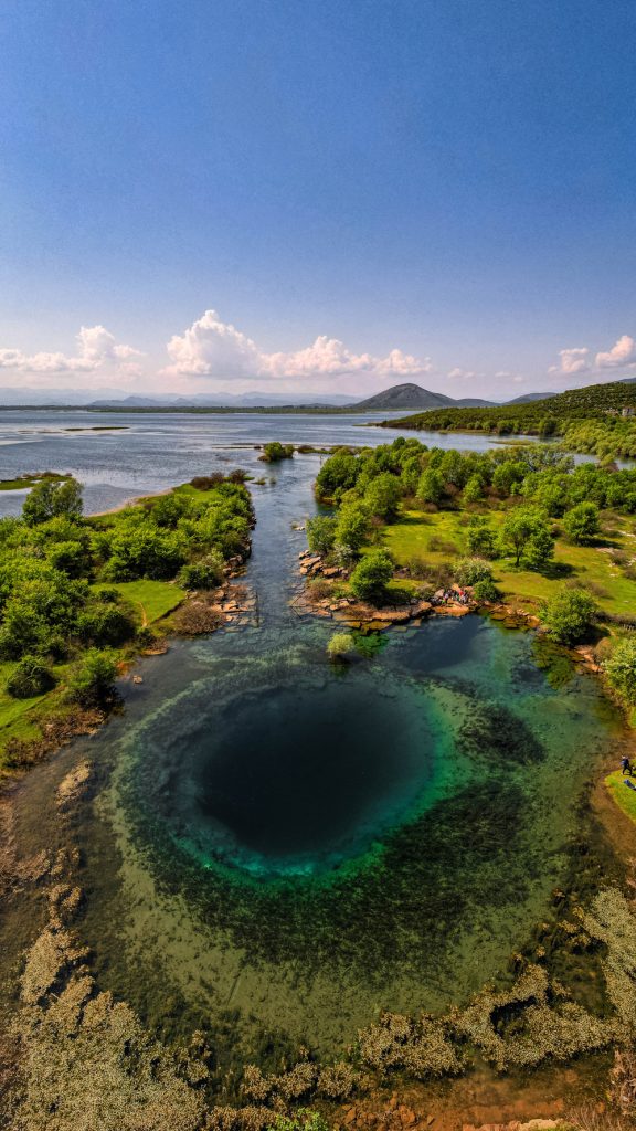
Syri i Sheganit

Pranë liqenit të Shkodrës, rreth 6 m mbi nivelin e detit gjendet monumenti natyror, Syri i Sheganit. Ai njihet ndryshe edhe me emrin “Sifoni i Virit”, Syri i Sheganit është një burim i madh karstic, që del vertikalisht nga një oxhak karstik, dhe lidhet me dy burime, uji i të cilëve vjen nga zona karstike e Alpeve perëndimore të Shqipërise. 

Ky monument është i pasur me lloje peshqish e gjallesa të tjera. Burimet e ujit krijojnë një mjedis tërheqës me vlera shkencore hidrologjike, didaktike, estetike, e turistike. Për të vizituar Syrin e Sehganit duhet të përshkosh rrugën Koplik – Ivanaj – Shegan.

Syri i Sheganit

Near Lake Shkodra, approximately 6 meters above sea level, lies the natural monument Syri i Sheganit. It is also known as the “Siphon of Viri.” Syri i Sheganit is a large karstic spring that emerges vertically from a karstic cavity and is connected to two springs, the water of which comes from the karstic area of the western Alps of Albania.

This monument is rich in fish species and other wildlife. The water sources create an attractive environment with scientific, educational, aesthetic, and touristic values. To visit Syri i Sheganit, you need to travel the road from Koplik to Ivanaj to Shegan.


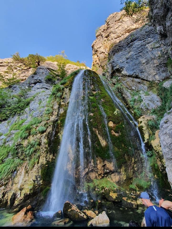
Ujëvara e Thethit

Një nga monumentet magjepsës të natyrës në Alpet e Shqipërisë është Ujëvara e Thethit, e cila ndodhet në fshatin Theth, pranë komuna Shalë, në qarkun e Shkodrës. Ajo ndodhet në lartësinë 900 m mbi nivelin e detit. 

Ujëvara e Thethit është 30 m e lartë dhe i dhuron tërë zonës një pamje mahnitëse. Ujëvara është një nga atraksionet më të vizituara nga turistët e huaj në fshatin malor të Thethit, në udhëtimin përgjatë rrugës Koplik – Theth. 


Theth Waterfall

One of the enchanting natural monuments in the Albanian Alps is Theth Waterfall, located in the village of Theth, near the Shalë municipality in the Shkodër region. It is situated at an altitude of 900 meters above sea level.

Theth Waterfall is 30 meters high and offers a breathtaking view to the entire area. It is one of the most visited attractions by foreign tourists in the mountainous village of Theth, along the journey along the Koplik – Theth road.

Olistolitet e Kodrës së Tepesë

Ky monument i natyrës shqiptare shtrihet në kodrat e Tepesë pranë Shkodrës dhe përbëhet nga dy blloqe gëlqerore të zonës tektonike të alpeve, me lartësi 10 – 15 m. Olistolitet vizitohen lehtë duke ndjekur rrugën për në kalanë e Rozafës. 

Shpella e Gajtanit

Kjo shpellë gjendet pranë fshatit Gajtan pjesë e komunës Gur i Zi. Pranë saj mund të gjeni edhe një vendbanim të fortifikuar ilir, i cili i përket epokës së hekurit. Këtë monument mund ta vizitoni teksa kaloni nëpër rrugën rurale Shkodër – Gur i Zi – Gajtan dhe në këmbë.  

Shpella e Jubanit

Shpella e Jubanit ndodhet rreth 300 m afër fshatit Juban në komunën Vau i Dejës. 

Ky monument natyror, i formuar nga procesi natyror karstik në gëlqeroret e trias – jures, me degëzime ende të panjohura dhe krijon disa zgjerime e mikroforma tërheqëse. Shpella e Jubanit vizitohet nëpërmjet rrugës Shkodër – Gur i Zi – Juban – si dhe rruga këmbësore pranë malit të Sheldisë.

Cirku i Gropës së Jezercës

Cirku i Gropës së Jezercës, i shpallur Monument Natyre, njihet edhe me emrin Gropa e Bukur e Jezercës, e cila është midis gropave ndërmalore më të përmendura. Ajo gjendet pranë fshatit Theth dhe përfaqëson gropë glacio – karstike në cirk akullnajor. 

Cirku i Gropës së Jezercës ka depozitim morenikë dhe 4 – 5 liqene të vegjël akullnajorë dhe vizitohet sipas rrugës Koplik – Theth – rruga këmbësore.

Olistoliths of Tepesa Hill

This Albanian natural monument stretches in the hills of Tepesa near Shkodër and consists of two limestone blocks from the tectonic zone of the Alps, with a height of 10-15 meters. The olistoliths are easily accessible by following the road to Rozafa Castle.

Gajtan Cave

This cave is located near the village of Gajtan, part of the Gur i Zi municipality. Near the cave, you can find an Illyrian fortified settlement dating back to the Iron Age. You can visit this monument while passing through the rural road from Shkodër to Gur i Zi to Gajtan on foot.

Cave of Jubani

 Cave of Jubani is located about 300 meters from the village of Juban in the municipality of Vau i Dejës.

This natural monument, formed by the karstic natural process in Triassic-Jurassic limestone rocks, features still unknown branching passages and creates several attractive enlargements and micro-formations.  Cave of Jubani can be visited through the road from Shkodër to Gur i Zi to Juban, as well as by footpath near the Sheldi Mountain.

Cirque of Jezercë Pit

The Cirque of Jezercë Pit, declared a Natural Monument, is also known as the Beautiful Cirque of Jezercë and is among the most mentioned intermountain pits. It is located near the village of Theth and represents a glacial-karstic pit in a glacial cirque.

Shpella e Thethit

Shpella e Thethit gjendet pranë fshatit Theth, 900 m mbi nivelin e detit pjesë e një prej peizazheve të jashtëzakonshme të malësisë shqiptare. Ajo është një shpellë, e cila krijon ngushtime e zgjerime, dhe degëzohet duke krijuar puse e mikroforma tërheqëse natyrore. Kjo shpellë vizitohet duke përshkuar rrugës rurale Koplik – Theth. 

Theth Cave

Theth Cave is located near the village of Theth, at an altitude of 900 meters above sea level, forming part of one of the extraordinary landscapes of Albanian highlands. It is a cave that features narrow passages and openings, branching out to create attractive natural formations. This cave can be visited by following the rural road from Koplik to Theth.

Portat e Shalës

Ky Monument Natyre gjendet në fshatin Breglum, të komunës Shalë. Ai përfaqëson një grykë lumore në formën e kanionit, të formuar nga lumi i Shalës në shkëmb gëlqeror paleozoikë me një gjatësi 50 m. Portat e Shalës janë lehtësisht të vizitueshme gjatë rrugës rurale Shkodër – Theth – Breg Lumi. 

Shala Gates

This Natural Monument is located in the village of Breglum, in the Shalë municipality. It represents a river gorge in the form of a canyon formed by the Shalë River in Paleozoic limestone rocks with a length of 50 meters. The Shala Gates are easily accessible along the rural road from Shkodër to Theth to Breg Lumi.

Liqeni i Jezercës

Liqeni i Jezercës, një nga pamjet më të bukura të Alpeve të Shqipërisë, gjendet në cirkun akullnajor të bllokut të Jezercës. Ai është një liqen me ujë të pastër kristal, sipërfaqja e të cilit gjatë stinës së dimrit është tërësisht e ngrirë. Biodiversiteti në këtë zonë të mrekullueshme natyrore është i larmishëm. Ky destinacion mund të vizitohet duke udhëtuar përdrejt rrugës automobilistike Shkodër – Theth  dhe më pas duke ndjekur shtegun e rrugës në këmbë, që të drejton për tek liqeni.

Lake Jezercë

Lake Jezercë, one of the most beautiful sights in the Albanian Alps, is located in the glacial cirque of the Jezercë massif. It is a crystal-clear lake, and during the winter, its surface freezes completely. The biodiversity in this marvelous natural area is diverse. You can visit this destination by traveling along the Shkodër-Theth road and then following the footpath leading to the lake.

Pisha Flamur e Qafës së Pejës

Monumenti natyror “Pisha Flamur” ndodhet në Qafën e Pejës, 1700 m mbi nivelin e detit. Ajo përbëhet nga një dru 200 – vjeçar me kurorë në formën e flamurit, me lartësi 20 m dhe diametër trungu 1,6 m. 

Pisha Flamur ka vlera shkencore, biologjike, ekologjike, kulturore, didaktike dhe turistike. Ky monument natyre mund të vizitohet kur përshkon rrugën rurale Shkodër – Theth –  si dhe në rrugë këmbësore. 

Pylli i ishullit të “Franc Jozefit”

Pylli i ishullit të Franc Jozefit, i emërtuar kështu për nder të perandorit austriak, gjendet në deltën e Bunës, afër fshatit Velipojë, 1,2 m mbi nivelin e detit. Me sipërfaqe 4.5 ha ky pyll përbëhet nga pemë plepi, verri etj, dhe rrënjë dushku deri në 75 – vjeçare, në rrezik zhdukjeje, me lartësi 12 – 16 m. Pylli i ishullit të Franc Jozefit përbën mjedis për folenizimin e shpendëve ujorë dhe mund të vizitohet përmes rrugës Shkodër – Velipojë – grykëderdhja e Bunës.

Flag Pine of Qafë Pejë

The natural monument “Flag Pine” is located at Qafë Pejë, at an altitude of 1700 meters above sea level. It consists of a 200-year-old tree with a crown in the shape of a flag, with a height of 20 meters and a trunk diameter of 1.6 meters.

Flag Pine has scientific, biological, ecological, cultural, educational, and touristic value. This natural monument can be visited by traversing the Shkodër-Theth road and also via a footpath.

The Forest of the “Franc Jozef” Island

The Forest of the “Franc Jozef” Island, named in honor of the Austrian emperor, is located in the delta of the Buna River, near the village of Velipojë, at an altitude of 1.2 meters above sea level. Covering an area of 4.5 hectares, this forest consists of trees such as black pine, oak, and others, with roots reaching up to 75 years old, facing the risk of extinction, and heights of 12-16 meters. The Forest of the “Franc Jozef” Island provides a habitat for waterfowl and can be visited via the Shkodër-Velipojë road and the Buna River estuary.

Shpërndaje
WEB agency Albania car rental tirana real estate saranda